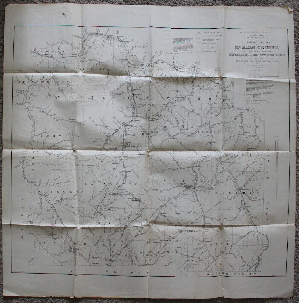
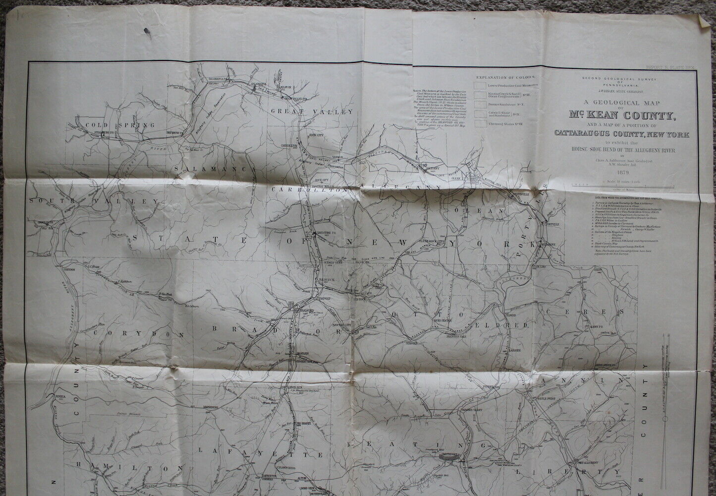
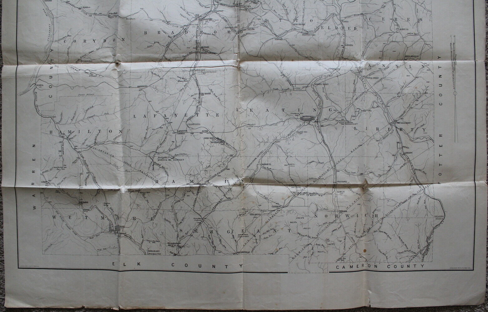

Boyer Brook, as in all other maps of this age, is called "Smiths Brook".
At top right: "REPORT R. PLATE NoX". At bottom right, "JULIUS BIEN PHOTOLITH. NEW YORK."
Minor tears at creases and edges.
| Name | "A Geological Map of McKean County" |
|
|---|---|---|
| Catalog ID | HCM4496 | |
| Year | circa 1879 | |
| Description | "SECOND GEOLOGICAL SURVEY | OF | PENNSYLVANIA. | J.P. LESLEY, STATE GEOLOGIST. | A GEOLOGICAL MAP | OF | McKEAN COUNTY, | AND A MAP OF A PORTION OF | CATTARAUGUS COUNTY, NEW YORK | to exhibit the | HORSE-SHOE BEND OF THE ALLEGHENY RIVER. | BY | Chas. A. ASHBURNER, Asst. Geologist. | A.W. Sheafer, Aid. | 1879. | Scale: 1 1/2 miles = 1 inch." Boyer Brook, as in all other maps of this age, is called "Smiths Brook". At top right: "REPORT R. PLATE NoX". At bottom right, "JULIUS BIEN PHOTOLITH. NEW YORK." Minor tears at creases and edges. |
|
| Added | 2020-07-26 13:34:47 | |
| Dimensions | 31.5x31.5 | |